


Washington D.C. Map and Walks
3.811.00 Reviews
App Specs
- Version
- 59
- Updated On
- License
- Free
- Downloads
- 10,000+
- Developer
- GPSmyCity.com, Inc.
- Categories
- Travel & Local
- Platform
- Android
Screenshots
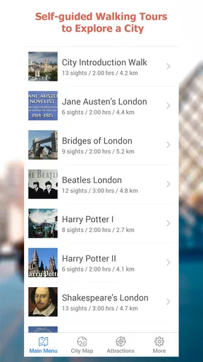
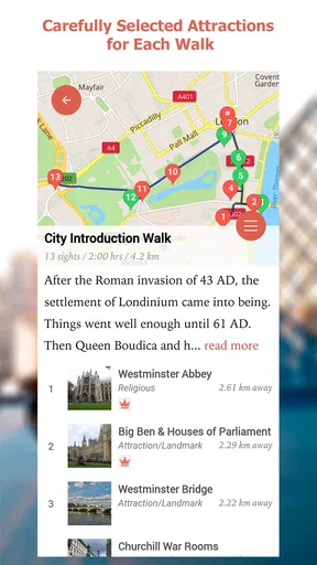
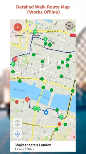
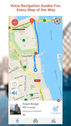


 Analysis by AppCompare
I like the idea behind Washington D.C. Map and Walks because it focuses on a very practical travel problem: deciding what to see next when you are already in the city. Instead of treating Washington, D.C. as one enormous checklist, the app is built around self-guided walks that can give a visit some structure. That makes it especially appealing for travelers who want to explore independently rather than follow a tour group or spend their whole day switching between search results.
This is a free travel and local app from GPSmyCity.com, Inc., aimed at everyone from first-time visitors to people making a short return trip. Its average rating is 3.8 from around fifty ratings, with roughly a dozen written reviews, and it has passed ten thousand installs. Those numbers suggest a small, focused product rather than a dominant navigation platform, so I approached it as a specialist walking companion, not as a replacement for a full map service.
How the app feels in a real Washington visit
The most useful way to think about this app is as a starting point for a walking plan. Washington has famous landmarks that are individually easy to find, but the real challenge is connecting them sensibly. A self-guided route can help turn a loose collection of attractions into a sequence: begin in one area, continue on foot, pause when something catches your attention, and finish somewhere that makes sense for the rest of the day.
That approach worked best for me when I wanted a flexible morning rather than a tightly scheduled tour. I could imagine opening the app after breakfast, choosing a walk that matched my location and available time, and using it to avoid the indecision that often comes with a large city map. The value is not simply showing that Washington has landmarks. It is reducing the mental work involved in deciding how to combine them.
It is also a good fit for travelers who dislike being talked at. A guided tour has its place, but it fixes the pace and often keeps the group moving even when you want a longer look at a building or a quiet break. With this app, the walk remains yours. You can stop for photographs, leave the route for lunch, or skip a point without feeling that you have fallen behind a guide.
On the other hand, I would not use it as my only travel tool. A walking app can organize sightseeing, but it is not the same thing as a complete city-navigation service. For transit changes, live traffic, restaurant discovery, accessibility planning, or checking an exact business location, a broader map application is usually more useful. The strongest setup is to use this app for sightseeing structure and keep a general map app available for everything around that structure.
A practical half-day workflow
For a realistic visit, I would prepare before leaving the hotel. I would look through the available walks, select one that fits the neighborhood I want to explore, and note its general direction before setting out. This small preparation matters because sightseeing apps are less helpful when opened for the first time while you are standing on a busy sidewalk, tired, hungry, and trying to decide between several parts of the city.
Worth Reading Before You Choose

EA SPORTS FC Mobile 26 Is a Bigger Football Game, but It Takes Time

Flipboard Shows What News Apps Must Do Beyond the Feed

Switching to Android Auto Means Rethinking Your Driving Routine

Google Calendar Makes a Crowded Week Easier to Manage

Ludo King Makes the Most of the Minutes Between Plans

Baby Panda World Brings Quick Play to Modern Phones, but Its Game Library Feels Busy
During the walk, I would treat the route as a suggestion rather than a command. Washington is full of places where a few extra minutes can change the experience: a quieter view, a better photograph, a museum entrance, or a shaded place to rest. The app is most useful when it supplies a backbone for the outing while leaving room for those spontaneous choices.
A family could use the same method differently. Parents might choose one walk as the main plan, then shorten it when children lose interest. A solo traveler could move more quickly and add detours. Someone visiting during a short work trip could use a route to make a limited evening feel purposeful instead of wandering without a plan. These are modest advantages, but they are exactly the kind that can make a city visit less tiring.
What the current version tells me
The current version is 59, which tells me the app has gone through a meaningful amount of maintenance since its original release on June 15, 2013. I would not interpret that number as proof that every part of the experience is modern, but it does indicate that this is not an untouched, abandoned listing. The product has remained available long enough to receive continued version changes.
That history gives the app a slightly unusual character. It feels like a focused travel utility that has stayed centered on its original purpose instead of expanding into a huge platform. I appreciate that restraint. A visitor who only wants Washington walking ideas does not necessarily need hotel booking, social feeds, travel deals, or a crowded collection of unrelated tools.
At the same time, a long product history raises a reasonable expectation: the basic experience should be easy to understand on a current phone. The app requires iOS 11 or later, so anyone using a supported device should check compatibility before traveling, particularly if the phone is old or has not been updated for a long time. The age requirement is not demanding by modern standards, but it is still worth checking before relying on the app during a trip.
The app is free to install, while in-app purchases are listed at $4.99 per item. That makes trying it low-risk, but I would still pay attention to what is available without an additional purchase before building a full itinerary around it. The sensible approach is to install it ahead of time, inspect the walks that matter to you, and decide whether the free portion is enough for your visit. That is better than discovering a purchase boundary after you have already started walking.
Where it beats ordinary map searching
A standard map is excellent when I already know the place I want to reach. It is less helpful when the question is, “What is a sensible walking experience from here?” Searching for individual landmarks can produce a scattered day, with too much time spent comparing pins and estimating distances. This app’s advantage is editorial structure: it frames sightseeing as connected walks rather than isolated destinations.
That distinction is important for visitors who are overwhelmed by Washington’s scale. The city’s major sights can look close together on a screen while still demanding considerable walking in practice. A route-based app encourages you to think in terms of one outing at a time. I find that more realistic than trying to cover every famous location in one ambitious plan.
It can also be more comfortable than a traditional audio tour for people who prefer reading and observing at their own pace. The trade-off is that a dedicated tour may offer richer storytelling, a human guide may answer questions, and a full map app may handle changing transport conditions better. The right choice depends on whether your priority is independent route planning, historical narration, or live logistics.
Small habits that make it more useful
One useful habit is to choose the walk according to energy, not just interest. A route that looks perfect in the morning may feel excessive after a museum visit or a long day of travel. I would keep one primary walk in mind and avoid stacking several sightseeing plans so tightly that the day becomes a race.
Another is to use the app before entering a landmark, not only after leaving it. Looking ahead can help you understand where the walk is heading and decide whether a long stop will make the rest of the route impractical. This is a simple planning trick, but it prevents the common problem of spending so much time at the first attraction that the remaining itinerary becomes rushed.
I would also make a personal backup plan. Save the name of the walk or write down its broad sequence before setting off, and keep your phone charged. That is not a criticism unique to this product; it is sensible travel practice whenever a phone is being used as a guide. It also makes the experience less stressful if you need to switch temporarily to another map for a street-level detail.
A less obvious trade-off is the difference between following a route and actually learning the city. A structured walk can help you see more in limited time, but it may also tempt you to focus on the next stop instead of noticing the spaces between stops. I get the best results when I use the route to understand the area, then deliberately allow a little unscheduled time. The app should support curiosity, not eliminate it.
Who should choose it, and who should skip it
I would recommend it to a visitor who wants independent sightseeing with more direction than a blank map provides. It is particularly suitable for a first trip, a short stay, or a day when you want to explore on foot without researching every connection yourself. It may also suit repeat visitors who have already seen the headline attractions and want a themed or neighborhood-based way to revisit the city.
It is less suitable for someone who expects live, all-purpose navigation. If your day depends on real-time transit information, frequent changes, detailed business listings, or turn-by-turn driving guidance, a general mapping service should remain your main tool. I would also hesitate to make it the central option for travelers who need highly specific accessibility information or a carefully verified route for mobility reasons; those needs deserve more detailed planning than a compact walking guide alone can provide.
Travelers who want deep historical interpretation may prefer an audio guide, a museum-led tour, or a well-researched guidebook. The app’s strength is helping you move through Washington with purpose, not replacing every other form of travel information. Knowing that boundary is important because it keeps expectations realistic.
What has changed for returning users
For someone who used the app years ago, the current version number suggests that the product has not simply remained frozen since its early release. Still, I would separate that evidence from assumptions about a dramatic redesign. A version progression shows ongoing updates, but it does not by itself tell me that every screen, route, or workflow has been transformed.
Existing users should therefore judge the current release by practical questions: does it present the walks clearly on their device, does the available content match the kind of visit they are planning, and does the purchase arrangement fit their expectations? Those checks are more useful than assuming that a mature version number automatically means a completely new experience.
The benefit for returning users is continuity of purpose. If they liked having Washington walks collected in one place, the app still serves that focused role. The potential friction is that travelers accustomed to modern map platforms may expect more live context and broader planning tools than this narrower product is designed to provide.
Remaining gaps and sensible expectations
The biggest limitation is scope. A collection of self-guided walks can make sightseeing easier, but it cannot answer every question that arises during a city break. It does not remove the need to consider weather, opening arrangements, walking stamina, meal breaks, crowd levels, or transportation between separate areas.
There is also a difference between having a route and having a complete itinerary. A route may guide the walking portion of a day, while the traveler still needs to decide how long to spend at each stop and what to do afterward. I see that as a manageable gap rather than a fatal flaw, provided the app is treated as one layer of planning.
The modest rating of 3.8 suggests a mixed but not disastrous reception. I would not use that figure as a verdict on every visitor’s experience, especially with a relatively small rating base, but it does reinforce my balanced view: this is a useful niche tool, not an essential download for everyone. Its value depends heavily on whether guided walking structure is what you actually need.
What I would watch before relying on it
If I were planning a future Washington trip, I would watch how well the app keeps its routes relevant as the city changes. Streets, entrances, public spaces, and visitor habits can evolve, so the long-term usefulness of any walking guide depends on maintenance as much as on its original concept. The continued presence of version 59 is encouraging, but I would still preview the content before traveling.
I would also watch the balance between free access and the $4.99 in-app items. A paid option can be reasonable when it unlocks material that genuinely improves a trip, but the decision should be clear enough for a traveler to make before leaving. Installing early gives you time to understand that arrangement without pressure.
Finally, I would watch whether the app remains pleasantly focused. More features are not automatically better for this kind of product. The best future direction would be improvements that make the walks easier to understand and use, while preserving the simple idea of exploring Washington independently.
My final view is favorable, with clear limits. Washington D.C. Map and Walks is a sensible companion for travelers who want a prepared walking framework without joining a group or doing all the route research themselves. It is free to try, rated for Everyone, and developed by GPSmyCity.com, Inc., making it approachable for a broad audience.
I would download it before a Washington visit, examine the available walks, and pair it with a general map app for live practical details. If you want a flexible sightseeing backbone, it can make the city feel more manageable. If you need comprehensive navigation, detailed accessibility planning, or rich guided narration, choose a more specialized alternative instead. In my experience, its best quality is not that it tries to do everything; it is that it gives an independent walk enough shape to become a genuinely useful part of the day.
Pros
- Offline maps make sightseeing possible without mobile data.
- Self-guided routes offer flexibility to explore at your own pace.
- Walking tours cover major landmarks and historic areas.
- GPS support helps you follow routes and locate nearby attractions.
- Useful for independent travelers who prefer not to join group tours.
Cons
- Some tour content may require an additional purchase.
- Route information may become outdated after road or site changes.
- Extended walks can be tiring
- especially during hot weather.
- GPS accuracy may decrease near tall buildings or indoors.
- The experience is less suitable for users seeking live tour guidance.
FAQs for Washington D.C. Map and Walks
What is Washington D.C. Map and Walks, and who is it designed for?
Washington D.C. Map and Walks is a self-guided sightseeing app created for visitors who want to explore the capital at their own pace. It combines walking routes with maps, descriptions, and information about notable landmarks, monuments, museums, and historic areas. It is particularly useful for independent travelers who prefer flexible itineraries instead of joining a scheduled group tour.
Does Washington D.C. Map and Walks work without an internet connection?
The app is intended to support sightseeing while walking around Washington, D.C., where mobile data may not always be convenient or affordable. Depending on the version and the specific content downloaded, map and tour information may be available offline. It is wise to open the desired tour before leaving Wi-Fi, download any required data, and confirm that location services and offline maps work correctly on your device.
What sights and walking tours are included in the app?
The app generally focuses on Washington, D.C.’s best-known attractions and historic districts, including major memorials, government buildings, museums, and areas connected with American history. Routes are organized as themed walks, allowing users to discover several nearby sights in one outing. Available tours and descriptions can vary by app version, so checking the current listing before downloading is recommended.
Does the app provide turn-by-turn navigation or a live tour guide?
Washington D.C. Map and Walks is better understood as a self-guided sightseeing companion than as a live guide or conventional navigation service. It can help users follow a planned route and learn about points of interest, but it may not provide the same detailed, continuously updated directions as Google Maps or Apple Maps. Users should still pay attention to signs, crossings, opening hours, and local conditions.
Is Washington D.C. Map and Walks free, and are there any limitations?
The download may be free or offered with selected content available at no cost, while additional tours, features, or complete access may require an in-app purchase. Pricing and included material can change according to the platform and the developer’s current offer. Before installing, review the store description, permissions, ratings, and purchase information so you understand exactly what is included.


